
For a geologist/cartographer like me, this could be as mesmerizing as Google Earth!
The U.S. Geological Survey has done an absolutely wonderful job of presenting geological maps online with its National Geologic Map Database MapView. This site offers a seamless view of geologic maps produced by the USGS and state geological surveys. A good geologic map in itself is a thing of beauty, and the USGS has done just about everything right in making this page both a work of art and easy to use. MapView is a useful tool as well, and can be used to locate and download the PDF geologic maps that were used to create it.
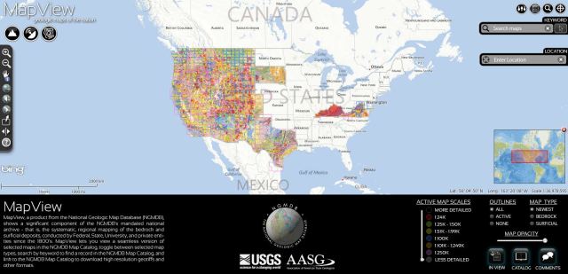
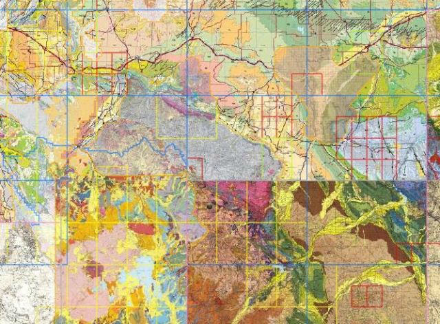

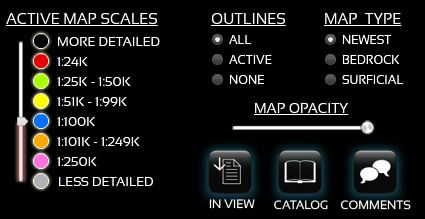
The only significant shortcoming is that this map shows raster data (images, scanned maps), so one cannot do queries on individual map polygons. When one uses the “Identify” tool, the site provides information about the map that is being viewed rather than the geological unit. On the Beartooth Mountains map above, for example, the Identify tool will open a window that says that the map is the “Preliminary Geologic Map of the Red Lodge 30′ x 60′ Quadrangle,” but will not tell not inform one that Jm is the Jurassic Morrison Formation, or that Asw4 is the Lower Anorthosite Zone of the Stillwater Complex; one would need to download the PDF map or report for that information. Still, this site will prove to be a great tool for viewing and downloading geological maps.
Grace and Peace

Hi Kevin, thanks for this link. A lot of the maps are in GIS format, which can then be converted to Google Earth kml format via a utility like shptokml: http://shp2kml.sourceforge.net/
if you haven’t seen them yet, and if you’re a Google Earth junkie like I am, you’ll like the USGS’ downloadable state geology kmls: http://tin.er.usgs.gov/geology/state/
LikeLike
Have you tried the Google earth icon on the download page (top right) after you use the identify tool? Very cool to see any of those maps in 3d! I find myself using the “In View” button all the time now….tons of additional geologic publications. Thanks for the post!
LikeLike
Paul — I had not seen the Google Earth icon. I had seen a snapshot of a Google Earth view on the USGS site, but hadn’t figured out how to get to it in the Mapview. Thanks a bunch.
LikeLike