
Today’s Astronomy Picture of the Day: Radar Indicates Buried Glaciers on Mars.
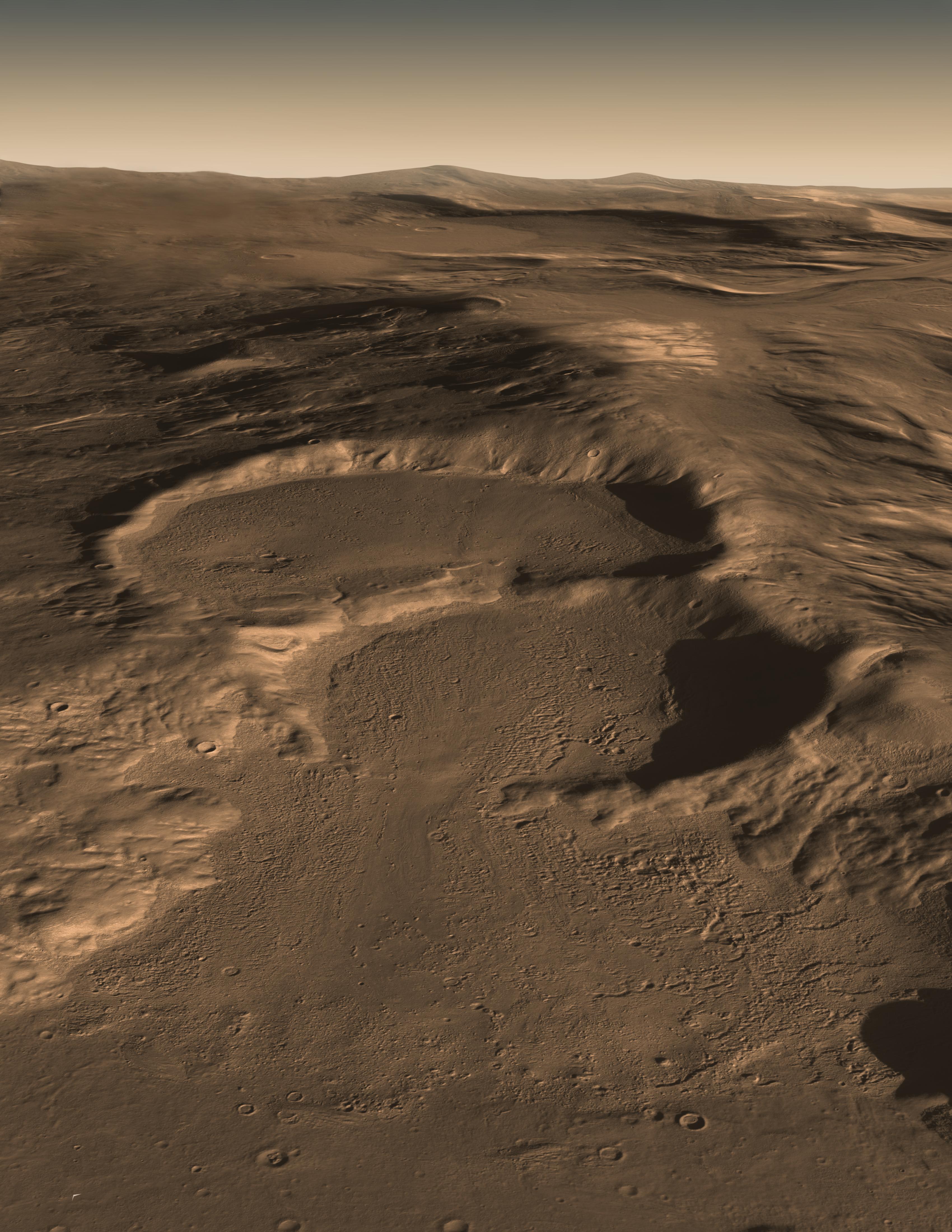
Explanation: What created this unusual terrain on Mars? The floors of several mid-latitude craters in Hellas Basin on Mars appear unusually grooved, flat, and shallow. New radar images from the Mars Reconnaissance Orbiter bolster an exciting hypothesis: huge glaciers of buried ice. Evidence indicates that such glaciers cover an area larger than a city and extend as much as a kilometer deep. The ice would have been kept from evaporating into the thin Martian air by a covering of dirt. If true, this would indicate the largest volume of water ice outside of the Martian poles, much larger than the frozen puddles recently discovered by the Phoenix lander. Such lake-sized ice blocks located so close to the Martian equator might make a good drinking reservoir for future astronauts exploring Mars.

The image above shows three large craters which radar data indicates are filled with water ice (as opposed to dry ice, which is frozen CO2), with a cover of soil which prevents the ice from subliming into the thin Martian atmosphere. The field of view is about 20 km across, and 50 km deep. The craters are found in the Hellas basin, which is the deepest impact crater on Mars.
In the higher resolution jpg file available at APOD, flow lines are clearly evident, which indicate that the ice has been in motion at least at some point in the past. There are also a few small impact craters on the surface of the glaciers (or are they some sort of subsidence pits formed as ice sublimes beneath the soil?).
The image below shows what this area would look like without the soil cover.

The second image is from from the Jet Propulsion Laboratory, not from APOD.
Grace and Peace

I wonder: just how thick the “thin” layer of soil would have to be to prevent sublimation? Or, if the layer was non-existent to when the glacier was “fresh”, how long did it take to reach the present state (of equilibrium?)?
LikeLike